Work
About
CONTACT
Work
About
CONTACT
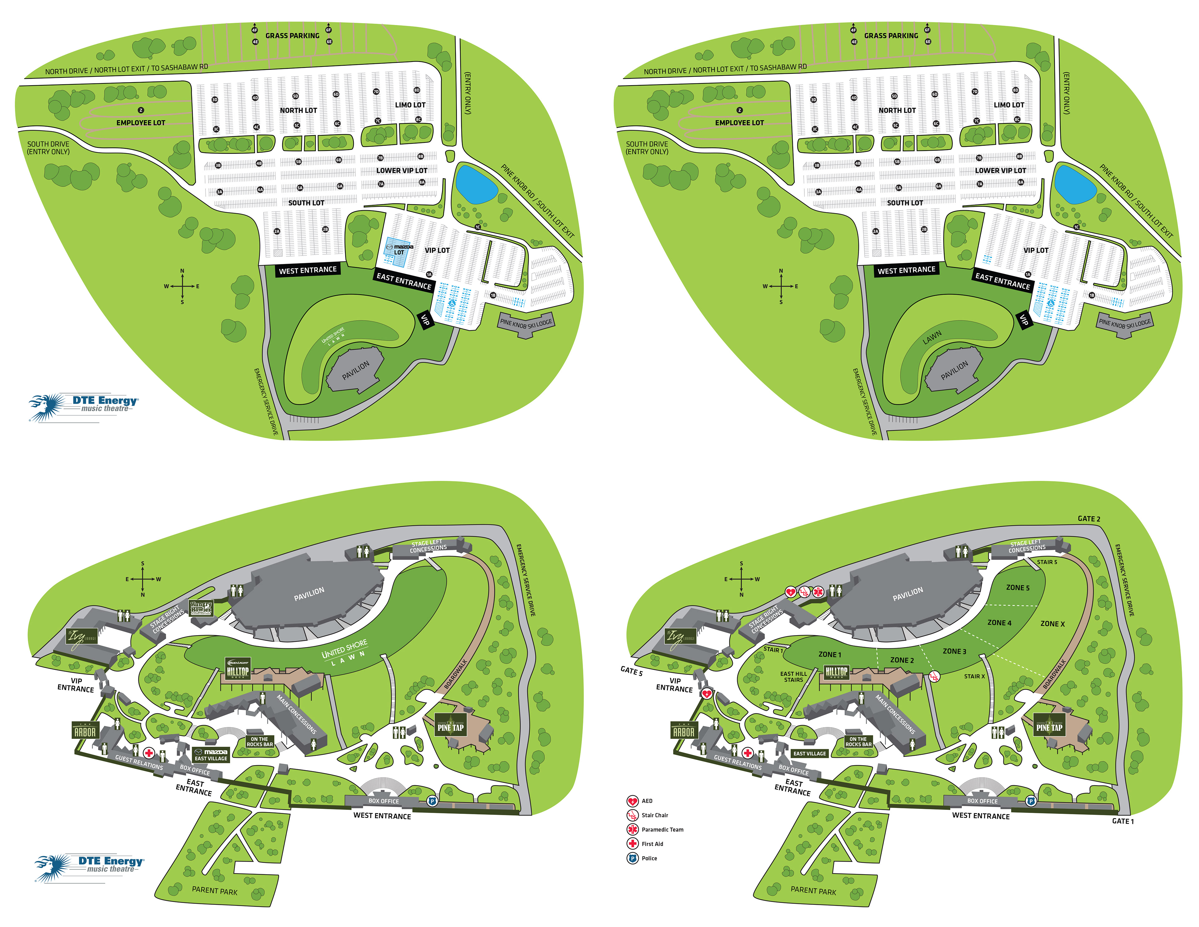
Wayfinding Maps for DTE Energy Music Theatre
These illustrations were created by tracing overhead satellite images of the actual venue to ensure accuracy. Different versions were created for public use and for facility patrol to use.
↑
Back to Top
Insert copy here, which should vary depending on your region.
Accept